
Файл:India Seemandhra locator map.svg

Эхинэй файл (SVG файл, нэрлэгдэһэн сенгынь 1643 × 1854 пиксельдэ, файлай хэмжээ: 1,08 Мб)
| Название |
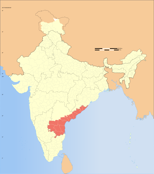
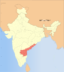
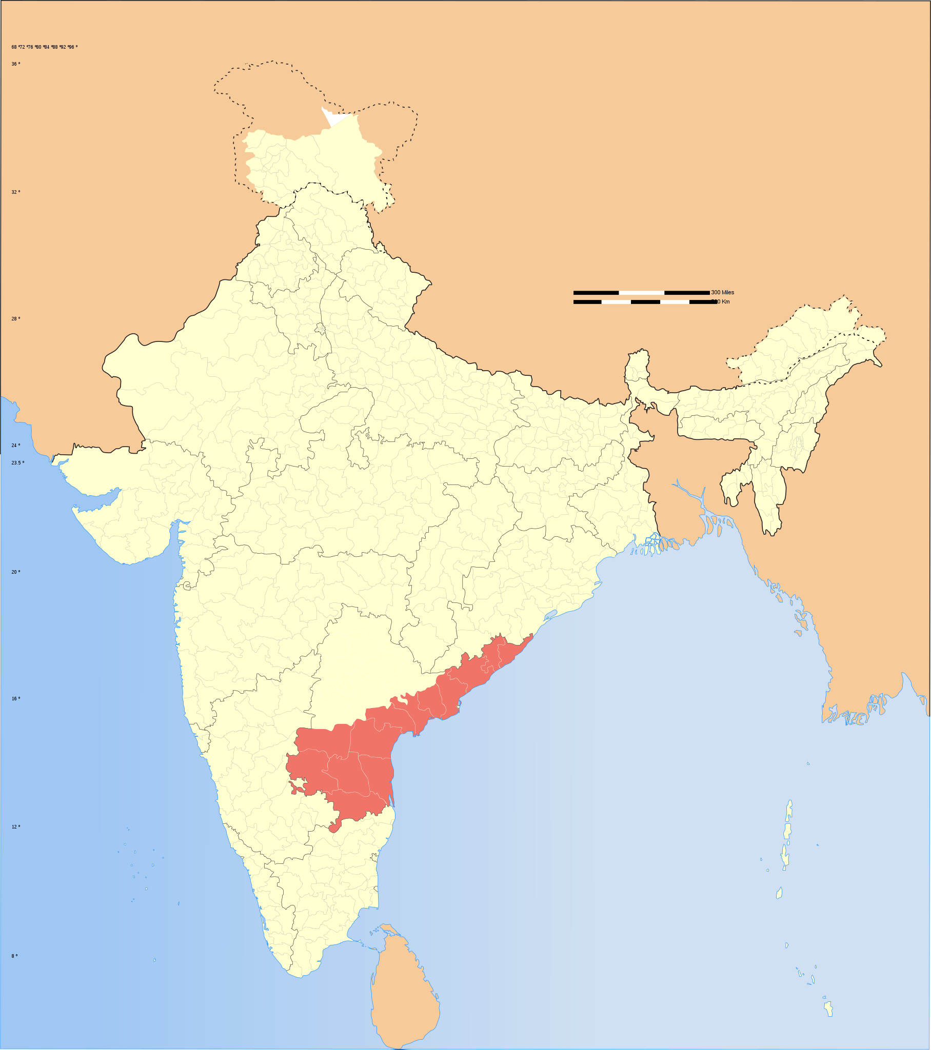
Andhra Pradesh locator map |
|||||||||
| Описание |
Locator map of the state of Andhra Pradesh (post Telangana statehood), India with district boundaries. |
|||||||||
| Map legend |
 |
|||||||||
| Һара үдэр | ||||||||||
| Эхин |
Өөрын ажал |
|||||||||
| Создатель |
Updated by RaviC |
|||||||||
| Эрхэнүүд (Энэ файл дахин хэрэглэлгэ) |
Я, владелец авторских прав на это произведение, добровольно публикую его на условиях следующей лицензии: Creative Commons Attribution-Share Alike 3.0 Unported гэһэн зүбшөөрэлөөр энэ файл хараха боломжотойт
|
|||||||||
| Geotemporal data | ||||||||||
| Изображённое время | вторая половина XX век и XXI век | |||||||||
| Система пространственной привязки | conic | |||||||||
| Bounding box |
|
|||||||||
| Georeferencing | If inappropriate please set warp_status = skip to hide. | |||||||||
| Archival data | ||||||||||
| Примечания | Part of WikiProject India Maps | |||||||||

Notes
Depiction of India's borders
- The territorial boundaries of India are shown as per the actual ground situation in accordance with international practices followed by the United Nations ([1], [2]) and the National Geographic Society ([3], [4])
- This map is meant to be for illustrative purpose only and is not authenticated by official government sources. Please check the list of sources and references used to create the map for a measure of accuracy and verifiability.
- The usage of these maps in India, Pakistan and China are governed by different laws that restrict depictions of boundaries other than what is officially recognized by the state. Please check local laws and modify the map accordingly before use.
Explanation of disputed boundaries


- Boundary of Indian claim : The territory India claims is legally theirs, but the claim is disputed by China and Pakistan.
- Line of Control/Line of Conflict : The de facto administrative boundary recognised by the international community. This UN ceasefire line is considered as a temporary solution to an ongoing conflict since the departure of the British Raj.
Borders of disputed regions
The depicted extent of the former territory of the British Indian Empire, succeeded by Republic of India, may not be accepted by few countries as legal due to ongoing border disputes:
- The northern Himalayan region of the disputed territory Indian-administered Kashmir is claimed by India including (Pakistan-administered Kashmir) and the Chinese-occupied territory of (Ladakh plateau). Since 1972, it is divided between all three countries. See also Line of Control and Line of Actual Control.
- Siachen glacier (shown white) is an actively contested region between India and Pakistan. Since 1984, the region is under Indian control.
- The northeastern territory of Arunachal Pradesh is almost entirely claimed by China as part of its Tibetan territory.
- Minor areas of eastern Kashmir's Ladakh division, Himachal Pradesh and Uttarakhand on the Chinese frontier are claimed by China. These areas are under Indian control.
- A small area of Uttarakhand adjoining the Nepal border along the Sarda river is disputed between the two countries.
For a detailed map of all disputed regions in South Asia, see Image:India disputed areas map.svg
Internal borders
The borders of the state of Meghalaya, Assam and Arunachal Pradesh are shown as interpreted from the North-Eastern Areas (Reorganisation) Act, 1971, but has yet to be verified.
Territorial waters
The limit of the territorial waters of India extends to twelve nautical miles measured from the appropriate baseline. See this for more information.
Файлай түүхэ
Һара үдэр/саг дээрэ даража, файлай тэрэ үеын байдал хаража болоно
| Һара үдэр/Саг | Багахан зураг | Хэмжээнүүд | Хабаадагша | Тайлбари | |
|---|---|---|---|---|---|
| мүнөөнэй | 21:29, 1 зургаа һара 2014 | | 1643 × 1854 (1,08 Мб) | RaviC | {{WikiProject_India_Maps |Title=Andhra Pradesh locator map |Description=Locator map of the state of Andhra Pradesh (post Telangana statehood), India with district boundaries. |Source= |Date=2008-12-29 |Author={{User:Pl... |
Файл хэрэглэлгэ
Энэ файл Удаадахи хуудаһан хэрэглэнэ:
Бүхы түсэлөөр файл хэрэглэлгэ
Энэ файл удаадахи викинүүдтэ хэрэглэгдэнэ гэбэл:
- as.wikipedia.org соо хэрэглэлгэ
- ba.wikipedia.org соо хэрэглэлгэ
- be-tarask.wikipedia.org соо хэрэглэлгэ
- be.wikipedia.org соо хэрэглэлгэ
- bg.wikipedia.org соо хэрэглэлгэ
- br.wikipedia.org соо хэрэглэлгэ
- bs.wikipedia.org соо хэрэглэлгэ
- cdo.wikipedia.org соо хэрэглэлгэ
- ceb.wikipedia.org соо хэрэглэлгэ
- cy.wikipedia.org соо хэрэглэлгэ
- dsb.wikipedia.org соо хэрэглэлгэ
- dv.wikipedia.org соо хэрэглэлгэ
- en.wikipedia.org соо хэрэглэлгэ
- fi.wikipedia.org соо хэрэглэлгэ
- fr.wikipedia.org соо хэрэглэлгэ
- Andhra Pradesh
- Nellore
- District du Godavari oriental
- Vizianagaram
- Machilipatnam
- Kurnool
- Tollywood
- Srikakulam
- Visakhapatnam
- Vijayawada
- Guntur (Inde)
- District de Visakhapatnam
- District de Nellore
- District de Guntur
- District de Krishna
- District de Kurnool
- District de Srikakulam
- District de Vizianagaram
- District d'Anantapur
- District de Chittoor
- Chittoor
- District du Godavari occidental
- District de Kadapa
- District de Prakasam
- Tirupati
- Eluru
- Ongole (ville)
- Anantapur
- Nandyal
- Madanapalle
- Adoni
- Bhimavaram
- Dharmavaram
- Hindupur
- Gudivada
- Guntakal
Энэ файлай ехэ хэмжээнэй хэрэглэлгые хараха.