
Файл:Mongols-map.png
Энэ уридшалан үзэлгын хэмжээн: 722 × 599 пиксель Зурагай ондоо нягтаралнууд: 289 × 240 пиксель | 578 × 480 пиксель | 925 × 768 пиксель | 1234 × 1024 пиксель | 1801 × 1495 пиксель.
Эхинэй файл (1801 × 1495 пиксельдэ, файлай хэмжээ: 2,79 Мб, MIME түхэл: image/png)
Тобшоор бэшэжэ харуулга
| Бэшэжэ харуулга |
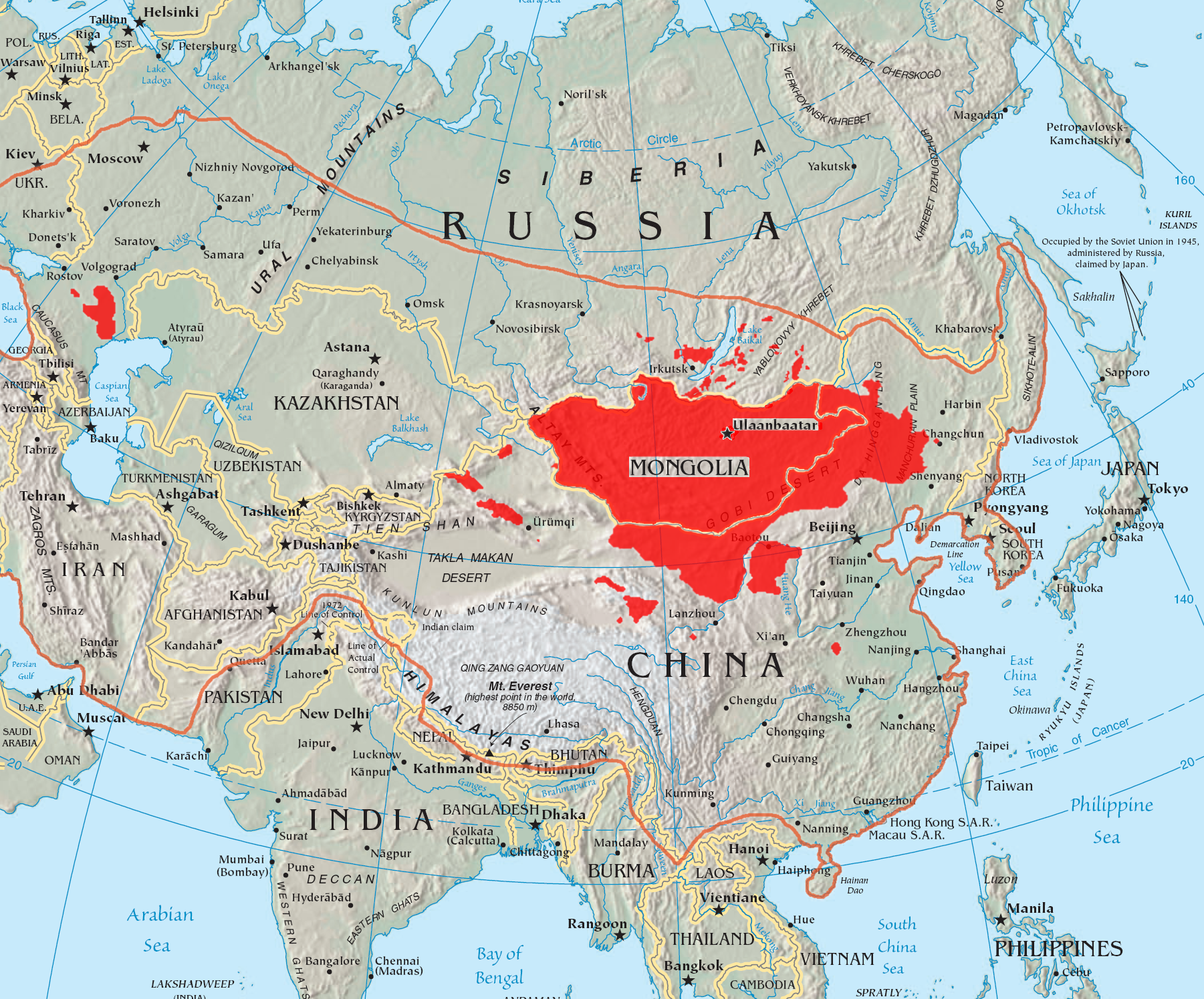
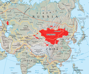
English: A map of the places that Mongol peoples live.
The orange line shows the extent of the Mongol Empire in the late 13th century. The red areas are the places dominated by ethnic Mongols. |
| Һара үдэр | |
| Эхин |
|
| Зохёогшо | Quadell |

|
Это изображение неизвестного типа «linguistic map» желательно воссоздать или аккуратно преобразовать в векторный формат SVG. Это даёт несколько преимуществ, прочитать о которых подробнее вы можете на странице Commons:Media for cleanup. Если вам уже сейчас доступна векторная версия данного изображения, загрузите её, пожалуйста, а затем замените этот шаблон на следующий: {{Vector version available|Имя загруженного файла.svg}}.
|
Зүбшөөрэл үгэлгэ
Я, владелец авторских прав на это произведение, добровольно публикую его на условиях следующих лицензий:

|
GNU Free Documentation License 1.2 хубилбариин гү, али бүри һүүлдэ Сүлөөтэ программна хангалгын жасын тунхаглаһан хубилбариин эрилтэнүүдтэй зохилдуулан, энэ дансые буулгабари хэжэ, дэлгэрүүлэн тараажа ба хубилгажа болохо юм. Тиихэдээ нэгэдэхи ба һүүлэй гадар хуудаһануудта табигдаһан һэлгэгдэхэгүй бүлэгүүд ба текстнүүдые дайража болохогүй.
GNU Free Documentation License гэһэн гаршагтай бүлэгтэ зүбшөөрэлэй буулгабари оруулагданхай. |
| Creative Commons Attribution-Share Alike 3.0 Unported гэһэн зүбшөөрэлөөр энэ файл хараха боломжотойт | ||
| ||
| Этот признак лицензирования был добавлен к этому файлу как часть обновления лицензии GFDL. |
Этот файл доступен по лицензии Creative Commons Attribution-Share Alike 2.0 Generic
- Та сүлөөгөөр хэхэ аргатайт:
- зохёол хубаалдаха – тус зохёол буулгабари хэхэ, тарааха ба дамжуулха
- үүсэжэ гараһануудые зохёохо – тус зохёол хубилгаха
- Удаадахи эрилтэнүүдые сахихада гэбэл:
- Тодоруулга – Та зохёогшын нэрэ зааха, зүбшөөрэлэй ссылкэ харуулха, мүн тиихэдэ ямаршьеб даа хубилалтануудые зохёогшо оруулаа гү гэжэ зааха ёһотойт. Ямаршье зүб аргаар энээниие хэхэдэ болоно. Гэбэшье, зүбшөөрэл баригша таниие гү, али тус зохёол хэрэглэхыетнай дэмжэнэ гэһэн һэжэг түрүүлэнгүй бүтээхэ болонот.
- тэрэл эрилтээрнь дэлгэрүүлгэ – Хэрбэеэ та тус зохёол хубилгаха гү, али тэрээн дээрэ үндэһэлэн, ондоо зохёол бүтээхэ гэбэл, эхин зохёолой зүбшөөрэл хэрэглэхэ гү, али [эхин зүбшөөрэлтэй тааралдаха https://creativecommons.org/share-your-work/licensing-considerations/compatible-licenses зүбшөөрэл] хэрэглэхэ уялгатайт.
Та энэ зүбшөөрэлнүүдэй алинииеньшье шэлэжэ абаха аргатайт.
Файлай түүхэ
Һара үдэр/саг дээрэ даража, файлай тэрэ үеын байдал хаража болоно
| Һара үдэр/Саг | Багахан зураг | Хэмжээнүүд | Хабаадагша | Тайлбари | |
|---|---|---|---|---|---|
| мүнөөнэй | 14:37, 29 таба һара 2023 | | 1801 × 1495 (2,79 Мб) | Artanisen | High resolution map with the same borders and areas as version 17:34, 16 July 2005 (UTC) |
| 20:13, 10 дүрбэ һара 2021 |  | 728 × 525 (279 Кб) | Fæ | Reverted to version as of 17:34, 16 July 2005 (UTC) Untrusted work of sockpuppets | |
| 03:35, 17 нэгэ һара 2019 |  | 728 × 525 (295 Кб) | Anchuhu | mongol | |
| 10:56, 22 зургаа һара 2017 |  | 728 × 525 (630 Кб) | 일성강 | Reverted to version as of 12:47, 1 June 2017 (UTC) | |
| 08:54, 17 зургаа һара 2017 |  | 728 × 525 (279 Кб) | Calthinus | Reverted to version as of 17:34, 16 July 2005 (UTC) | |
| 12:47, 1 зургаа һара 2017 |  | 728 × 525 (630 Кб) | 일성강 | fixed | |
| 17:34, 16 долоо һара 2005 |  | 728 × 525 (279 Кб) | Hottentot~commonswiki | This is a map of the places that Mongol peoples live. The information is based off of w:en:Image:Mongolsethnic.jpg, and the map I started with is w:en:Image:Asia-map.png. The orange line shows the extent of the Mongol Empire in the late 13th c | |
| 13:14, 16 долоо һара 2005 |  | 728 × 525 (297 Кб) | Quadell | This is a map of the places that Mongol peoples live. The information is based off of [:w:en:Image:Mongolsethnic.jpg]], and the map I started with is w:en:Image:Asia-map.png. The orange line shows the extent of the Mongol Empire in the late 13th ce |
Файл хэрэглэлгэ
Энэ файл хэрэглэһэн хуудаһанууд үгы.
Бүхы түсэлөөр файл хэрэглэлгэ
Энэ файл удаадахи викинүүдтэ хэрэглэгдэнэ гэбэл:
- af.wikipedia.org соо хэрэглэлгэ
- an.wikipedia.org соо хэрэглэлгэ
- ar.wikipedia.org соо хэрэглэлгэ
- arz.wikipedia.org соо хэрэглэлгэ
- ast.wikipedia.org соо хэрэглэлгэ
- azb.wikipedia.org соо хэрэглэлгэ
- ba.wikipedia.org соо хэрэглэлгэ
- be-tarask.wikipedia.org соо хэрэглэлгэ
- be.wikipedia.org соо хэрэглэлгэ
- bg.wiktionary.org соо хэрэглэлгэ
- bh.wikipedia.org соо хэрэглэлгэ
- br.wikipedia.org соо хэрэглэлгэ
- bs.wikipedia.org соо хэрэглэлгэ
- ca.wikipedia.org соо хэрэглэлгэ
- ckb.wikipedia.org соо хэрэглэлгэ
- cs.wikipedia.org соо хэрэглэлгэ
- cv.wikipedia.org соо хэрэглэлгэ
- da.wikipedia.org соо хэрэглэлгэ
- diq.wikipedia.org соо хэрэглэлгэ
- dsb.wikipedia.org соо хэрэглэлгэ
- el.wikipedia.org соо хэрэглэлгэ
- en.wikipedia.org соо хэрэглэлгэ
Энэ файлай ехэ хэмжээнэй хэрэглэлгые хараха.